North British Columbia itinerary
- Sep 30, 2019
- 7 min read
Updated: Aug 29, 2023
The little known and wild north of British Columbia offers us great mountains (Coast Mountains), unexplored coasts and, above all, infinite extensions of forests. Only traveled by a few roads: the most beautiful in the universe. There is a lot of wildlife. I will be surprised if on these lonely roads you do not run into bears, deer or elk. On the other hand, the facial features of people indicate that we are in an area with much more native character. The farther north you go, the more this becomes apparent. This area is huge and I only got to know a handful of sites. Here we will see those places that I know first hand, but another interesting option is to get carried away by those green roads and find new places. Here we go:
Prince Rupert
Road 16 or Yellowhead Highway (Prince Rupert – Terrace)
Terrace – Kitimat
Kalum Lake Road to Gitwinksihlkw
Road 16 or Yellowhead Highway: Terrace – Kitwanga
Stewart Cassiar Highway
Alaska Highway
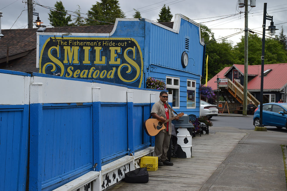
PRINCE RUPERT
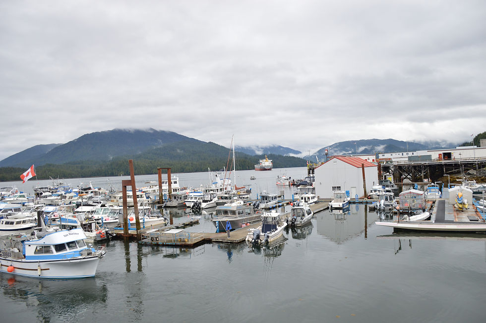
This isolated town at the gates of eastern Alaska can be reached by land (driving a lot from the east), sea and air. We arrived by ferry from Vancouver Island (Port Hardy), on an amazing trip between fjords. The downtown area is lively and beautiful, with constructions of striking colors that contrast with that lugubrious air that the clouds give. It is rare that the sun comes out. Here people live mainly from fishing and tourism that is starting to bloom. It was about time, because it is a wonderful place. Besides the sea and giant forests only interrupted by rivers and amazing lakes there are many possibilities to see wildlife in the surroundings... Even in the city itself! Do not get surprised to see deer in the streets. Recommended things to see and do:
Downtown. It is very nice to walk through the central streets, the port and the main square. There are several good restaurants to treat yourself with seafood and other local dishes.
North Pacific Cannery Museum. A museum that tells the story of an industry that played an integral role in the economic, cultural and natural development of BC during the last century. Today closed but very well preserved with its original architecture, converted into a museum.
Yellowhead Highway. This road connects with Terrace (see below), but if you do not want to get that far you should at least drive for a while next to the Skeena river with all those mountains in the background. A very cute park where you can go for a picnic is the Diane Lake Provincial Park.

Khutzeymateen Grizzly Bear Sactuary. The only Grizzly sanctuary in Canada is an expensive excursion, not very suitable for the backpacker budget, but everyone who makes it comes out in awe (I did not do it but everyone recommends it). Not only because it is full of grizzly bears enjoying in its natural environment, but also because the tours that operate are reputed to respect these beings and their environment as much as possible. You will be leaving from Prince Rupert either by boat or by plane. The boat trip is long, but it's worth it for the nature that is left behind. Many see whales, killer whales and other marine life along the way. Discover more on the website of the only lodge in the sanctuary: http://www.khutzlodge.com/
ROAD 16 OR YELLOWHEAD HIGHWAY: PRINCE RUPERT TO TERRACE

Many are those who, after disembarking a few days in Prince Rupert, continue heading north traveling by ferry to eastern Alaska... But they miss a jewel in the east of the city, in the way to Terrace. The road that connects with Terrace goes parallel to the fantastic and powerful Skeena river and is full of viewpoints and majestic rest areas. In addition, you can take a detour through some lumberjack road and find yourself alone with a magical lake or river.
TERRACE TO KITIMAT

The scenic Route 37 from Terrace to Kitimat is also worth doing. As in the Yellowhead Hwy, the road invites you to stop all the time: sandy lake beaches, forests, campsites, picnic areas with tables... Both towns are also interesting, but the best are the surroundings. Terrace surroundings in particular, since it doesn't matter where you go: west (Prince Rupert), south (Kitimat), east (Kitwanga) or north (next section!).
KALUM LAKE ROAD TO GITWINKSIHLKW

This road is another ode to nature. The route winds at first through areas of different altitudinal levels, passing by great lakes (highlights the Kitsumkalum Lake), powerful rivers, infinite forests... There is hardly tourism or populations, it feels very wild in here. And then, as if by magic, there is a drastic change of landscape. The green gives way to a bare area, the legacy that Mother Earth has left of extinct volcanic activity. After passing the beautiful Lava Lake begins the Nisga'a Provincial Park, with its magmatic fields... And beautiful waterfalls in between. A totally unexpected black landscape. I made it to the Gitwinksihlkw indigenous community, where in addition to nature, some totems of native art stand out. But the road continues, west to Gingolx, and north to Kitwanga.
ROAD 16 OR YELLOWHEAD HIGHWAY: TERRACE TO KITWANGA

The road that connects Terrace with Kitwanga - another piece of the Yellowhead hwy - is another show. "Chasing" the Skeena river, and large tracts of forests and mountains accompanying the road. Once again you can get into any little road that deviates to enjoy nature's full peace at its best. Highlights include the Kleanza Creek Provincial Park (it has a nice campground by the river) and the Seven Sisters Provincial Park, one of the most popular attractions.
The community of Kitwanga is something interesting to see. This native town that has been forced to adapt to the new times rests on a valley between mountains where bears abound. Actually from now on, on the Stewart Cassiar Road heading north, you can find bears everywhere.
STEWART CASSIAR HIGHWAY

My favorite road in Canada and probably in the world. From Kitwanga to Watson Lake, over 750 kilometers of pure nature, only interrupted by a few communities. Mountains, forests, lakes... A show that seems never to end. There are many bears in the area, so you have to go with caution. You can wild camp or go to the few existing campsites or cabins along the road. Also, unlike the other route that goes up to the Yukon - the Alaska Highway - this is an empty road. Very few people take this path, which makes it more special. I recommend taking a road on the way north and the other on the way back to experience the two of them, because both are worth it. But if you have to choose one, the Stewart Cassiar Road is my favorite. You can travel at your whim, stopping where you like. Some recommended stops:
Meziadin Lake. Beautiful lake. There is a campsite if you prefer a safer place to spend the night with your tent.
Bear Glacier Provincial Park and Stewart. From Meziadin Junction, there is a road to the west that takes you to this incredible village between mountains and settled on an arm of the Pacific (the Portland Canal). The road includes a majestic glacier - Bear Glacier - that comes to die in a beautiful lake. In fact the road is called Glacier Hwy. One of the most peculiar things is that from Stewart you can go to Hyder, in Alaska, excursion that besides allowing you to boast that you have stepped on Alaska, has a special place very close: the Fish Creek Wildlife Observation Site hosts salmon in the summer season... And many bears come to fill their hungry stomachs. Enjoy the show.
Kinaskan Lake Provincial Park. On this magical lake sits a lovely campsite.
Boya Lake Provincial Park. Already close to the border with the Yukon awaits this emerald lake to the delight of the few who visit it. You can do some short walk around and stretch your legs.
In this link you can see all the wonders that await on this road: http://www.stewartcassiarhighway.com/attractions/mount-edziza-provincial-park
ALASKA HIGHWAY

One of the most popular and adventurous routes in the world. Here converge families in RVs (caravans), backpacking hitchhikers, and many bikers. Everyone wants the same: go to the wild north! The whole route is beautiful, crossing the southernmost part of the Rocky Mountains, rivers, forests, lakes, dodging bison, bears and deer... An incredible visual spectacle that remains for 1365 miles (2200 km) between the north of BC (Dawson Creek), crossing the south of the Yukon and up to Delta Junction (Alaska). As we are describing the itineraries in northern British Columbia, we will stick to some stops that can be made in this section. For more information about this road in the Yukon you can read the itineraries through the Yukon. Some of the most popular stops are (from north to south):
Sign Post Forest, Watson Lake. First population in the Yukon, almost on the border with BC. Here is an interesting tourist attraction. Back in 1942, when the Alaska Hwy was being built, a worker put up a sign with the distance pointed to his hometown. Little by little other guys began to imitate him... An idea that has ended up doing that everyone who passes by here can put the sign of her/his address. Today there are more than 80,000 sign posts! A kind of extravagant museum.
Liard River Hot Springs Provincial Park. Home of the largest natural thermal water source in the whole country. A warm river surrounded by trees that you will never want to leave. It has a campsite that opens year round. Imagine swimming in this place in the middle of Canadian winter!

Photo taken from ourbc.com
Muncho Lake Provincial Park. Just 30 km from Liard River Hot Springs we have this beautiful lake in the northernmost (and least traveled) part of the Rocky Mountains.
Stone Mountain Provincial Park. A place that deserves to be explored for those who have time and like the least touched places by man. The official link of BC Parks of this Park, in case someone is encouraged to do some route: http://www.env.gov.bc.ca/bcparks/explore/parkpgs/stone_mt/
Sikanni Chief Falls Protected Area. The star element of this Park is the beautiful waterfall of 30 meters, but there is much more. If you have time to explore this area, take a look at the BC Parks website: http://www.env.gov.bc.ca/bcparks/explore/parkpgs/sikan_fl/


_edited.png)